ช่วยจับคู่ภาพถ่ายดาวเทียมหน่อยค่ะ จับคู่จนงงไปหมดแล้วค่ะ เหมือนจะง่ายแต่ไม่ง่ายเลย ใครรู้ช่วยสอนหน่อยนะคะ (บางภาพตอบได้มากกว่า 1)
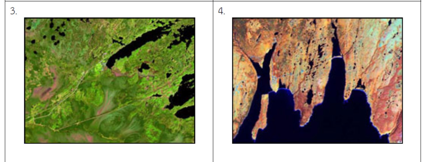
a) Two race tracks, a smaller one inside a larger one. Some roads and two golf courses are also visible in the image.
สนามแข่งสองลู่วิ่งที่มีลู่ขนาดเล็กซ้อนอยู่ในลู่ขนาดใหญ่ มีถนนอยู่บ้างและสนามกอล์ฟที่สามารถมองเห็น
จากภาพ......
b) An airport at the edge of a city. You can also see a smaller river joining a larger river in the image.
มีสนามบินบริเวณชานเมือง และยังสามารถเห็นแม่น้ำสายเล็กไหลลงมารวมกับแม่น้ำสายใหญ่ในภาพ.......
c) The effect of a cyclone on the surface of ocean waters.
ผลจากพายุไซโคลนบนพื้นผิวน้ำในมหาสมุทร........
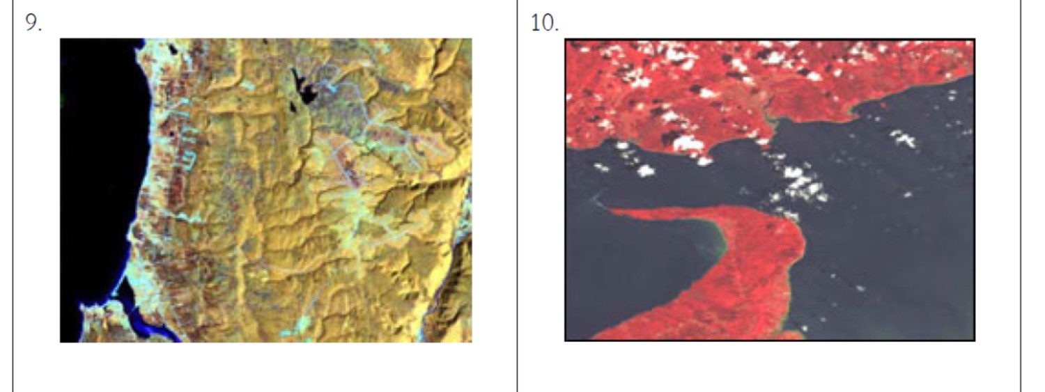
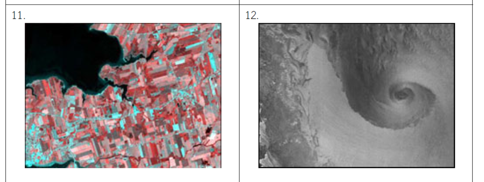
d) A smooth coastline showing a coastal town and its breakwater which creates a safe harbour for boats.
แนวชายฝั่งทะเลที่ราบเรียบแสดงถึงเมืองชายฝั่งทะเลและกำแพงกั้นแนวคลื่นซึ่งสร้างท่าเรือที่ปลอดภัยไว้สำหรับจอดเรือ........
e) 5 bridges across a river. Three of the bridges also pass over islands in the river.
มี 5 สะพานที่ทอดข้ามแม่น้ำ และ 3 ใน 5 ของสะพานนั้นยังพาดผ่านเกาะในแม่น้ำด้วย.......
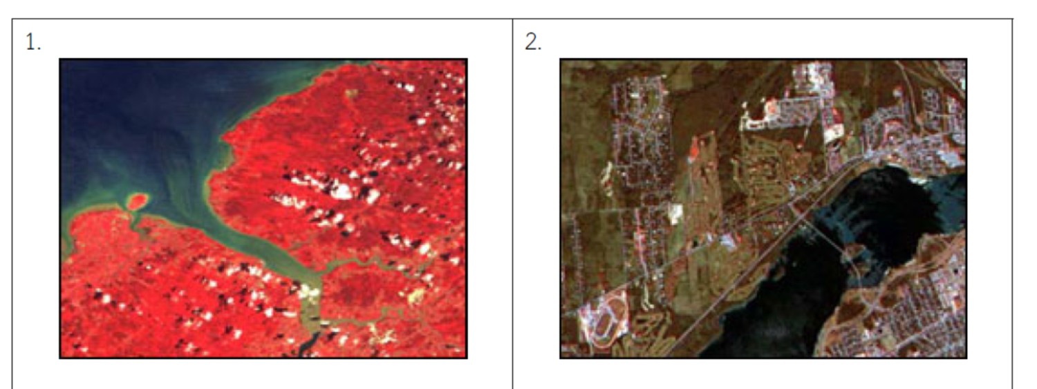
f) There are many clouds (and their shadows) over land and water in this image.
มีเมฆมากมายรวมถึงเงาของเมฆด้วยเหนือพื้นดินและพื้นน้ำในภาพ........
g) A coastal area showing ice flows in the largest of the inlets. The land area is studded with lakes and there are many islands offshore.
พื้นที่ชายฝั่งทะเลซึ่งแสดงการไหลของน้ำแข็งในเวิ้งที่ใหญ่ที่สุด ทะเลสาบมากมายในพื้นดินและหมู่เกาะมากมายนอกชายฝั่ง.......
h) A hook-shaped peninsula ending in a point.
มีจุดสิ้นสุดคาบสมุทรเป็นรูปตะขอ.........
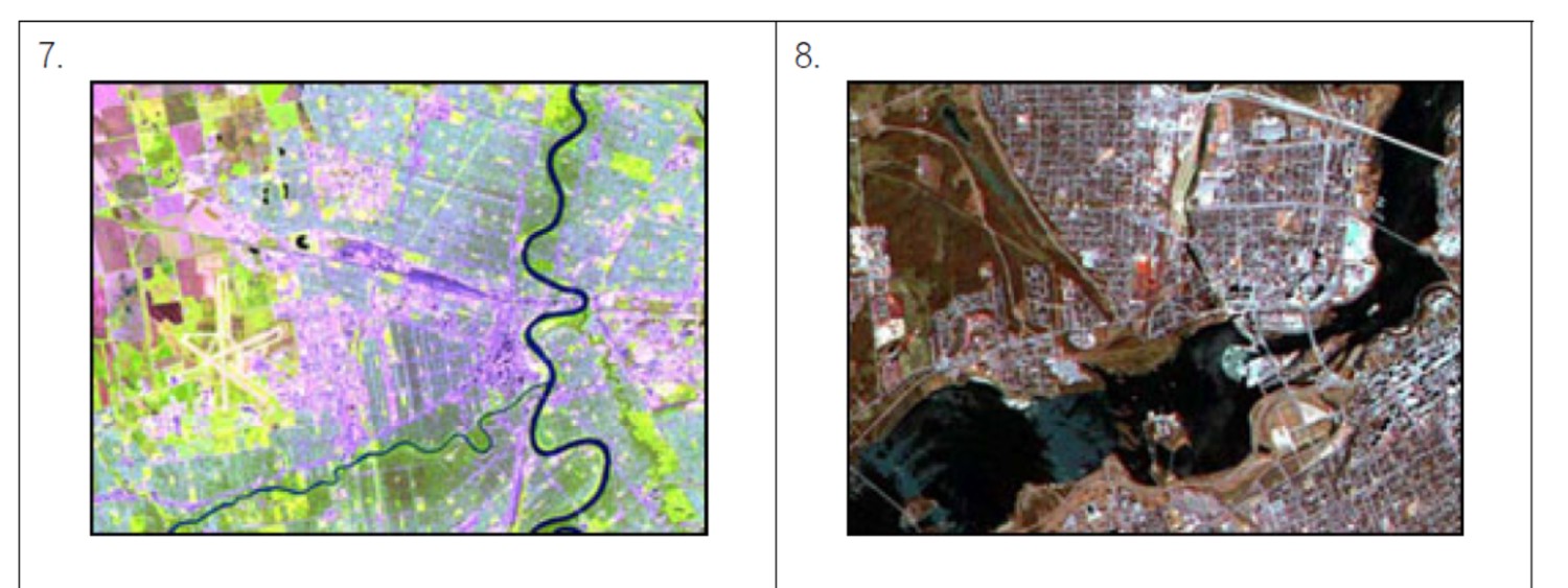
i) A rugged coastline showing many sharp coves and inlets.
ชายฝั่งทะเลที่ขรุขระแสดงเวิ้งน้ำและอ่าวที่แหลมคมจำนวนมาก..........
j) This scene shows farmland near the mouths of 2 rivers. You can also see several roads meeting at a village.
ในภาพแสดงพื้นที่ไร่นาใกล้ปากแม่น้ำ 2 สาย และสามารถมองเห็นถนนหลายสายในหมู่บ้าน.......
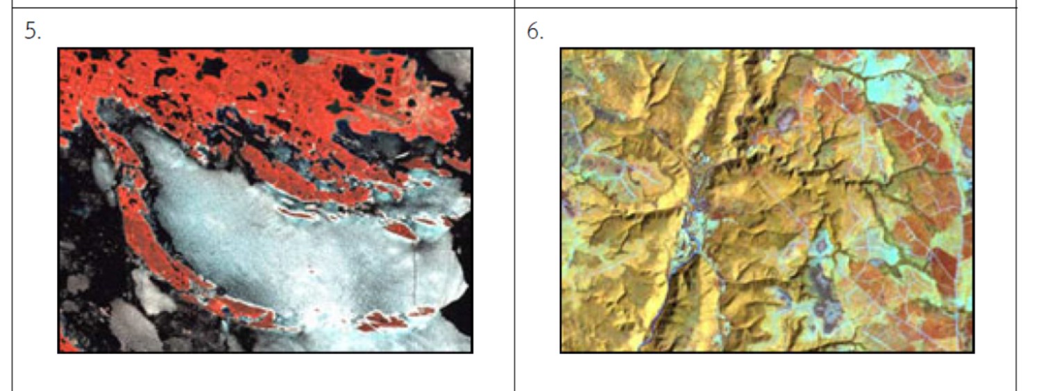
k) In this view you see many lakes in a rugged and rocky forest area. A large swampy section shows no lakes at all.
ในมุมมองนี้จะสามารถมองเห็นทะเลสาบหลายแห่งและป่าไม้ไม่สม่ำเสมอ รวมถึงพื้นที่ชุ่มน้ำขนาดใหญ่ที่ไม่มีทะเลสาบอยู่ภายใน........
l) A forested region showing clear-cut areas as well as the logging roads that were built to access this site.
ในเขตพื้นที่ป่าไม้แสดงบริเวณที่โดนตัดแล้วและโครงข่ายถนนที่ถูกสร้างเพื่อเข้าไปในพื้นที่นั้น........
m) A mouth of a river showing the sediment that is carried by the river into the sea.
พื้นที่ปากแม่น้ำแสดงตะกอนที่ถูกพาลงสู่ทะเลโดยแม่น้ำ........


ช่วยด้วยค่ะ ภาพถ่ายดาวเทียมทำเราหัวหมุนแล้ว(มึนหัวไปหมด)
a) Two race tracks, a smaller one inside a larger one. Some roads and two golf courses are also visible in the image.
สนามแข่งสองลู่วิ่งที่มีลู่ขนาดเล็กซ้อนอยู่ในลู่ขนาดใหญ่ มีถนนอยู่บ้างและสนามกอล์ฟที่สามารถมองเห็น
จากภาพ......
b) An airport at the edge of a city. You can also see a smaller river joining a larger river in the image.
มีสนามบินบริเวณชานเมือง และยังสามารถเห็นแม่น้ำสายเล็กไหลลงมารวมกับแม่น้ำสายใหญ่ในภาพ.......
c) The effect of a cyclone on the surface of ocean waters.
ผลจากพายุไซโคลนบนพื้นผิวน้ำในมหาสมุทร........
d) A smooth coastline showing a coastal town and its breakwater which creates a safe harbour for boats.
แนวชายฝั่งทะเลที่ราบเรียบแสดงถึงเมืองชายฝั่งทะเลและกำแพงกั้นแนวคลื่นซึ่งสร้างท่าเรือที่ปลอดภัยไว้สำหรับจอดเรือ........
e) 5 bridges across a river. Three of the bridges also pass over islands in the river.
มี 5 สะพานที่ทอดข้ามแม่น้ำ และ 3 ใน 5 ของสะพานนั้นยังพาดผ่านเกาะในแม่น้ำด้วย.......
f) There are many clouds (and their shadows) over land and water in this image.
มีเมฆมากมายรวมถึงเงาของเมฆด้วยเหนือพื้นดินและพื้นน้ำในภาพ........
g) A coastal area showing ice flows in the largest of the inlets. The land area is studded with lakes and there are many islands offshore.
พื้นที่ชายฝั่งทะเลซึ่งแสดงการไหลของน้ำแข็งในเวิ้งที่ใหญ่ที่สุด ทะเลสาบมากมายในพื้นดินและหมู่เกาะมากมายนอกชายฝั่ง.......
h) A hook-shaped peninsula ending in a point.
มีจุดสิ้นสุดคาบสมุทรเป็นรูปตะขอ.........
i) A rugged coastline showing many sharp coves and inlets.
ชายฝั่งทะเลที่ขรุขระแสดงเวิ้งน้ำและอ่าวที่แหลมคมจำนวนมาก..........
j) This scene shows farmland near the mouths of 2 rivers. You can also see several roads meeting at a village.
ในภาพแสดงพื้นที่ไร่นาใกล้ปากแม่น้ำ 2 สาย และสามารถมองเห็นถนนหลายสายในหมู่บ้าน.......
k) In this view you see many lakes in a rugged and rocky forest area. A large swampy section shows no lakes at all.
ในมุมมองนี้จะสามารถมองเห็นทะเลสาบหลายแห่งและป่าไม้ไม่สม่ำเสมอ รวมถึงพื้นที่ชุ่มน้ำขนาดใหญ่ที่ไม่มีทะเลสาบอยู่ภายใน........
l) A forested region showing clear-cut areas as well as the logging roads that were built to access this site.
ในเขตพื้นที่ป่าไม้แสดงบริเวณที่โดนตัดแล้วและโครงข่ายถนนที่ถูกสร้างเพื่อเข้าไปในพื้นที่นั้น........
m) A mouth of a river showing the sediment that is carried by the river into the sea.
พื้นที่ปากแม่น้ำแสดงตะกอนที่ถูกพาลงสู่ทะเลโดยแม่น้ำ........